 Skip to content

Hiking in the Algarve: The Best Trails, Coast to Mountains
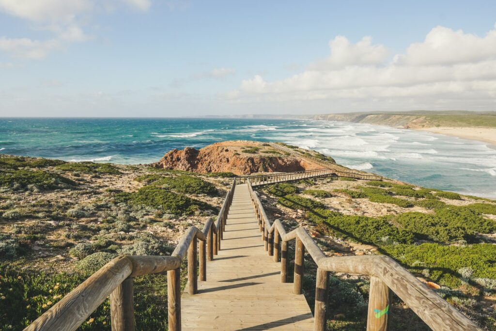
Cliff walks, the Rota Vicentina, the Via Algarviana and the Fóia hills compared, with sourced distances, honest difficulty and the best months.
The best Algarve hiking is a coast-to-mountains choice: clifftop walks in spring and autumn, long-distance routes on the Rota Vicentina and Via Algarviana, and cooler hill walking around Monchique.
For a first walk, the Seven Hanging Valleys trail near Carvoeiro is the easiest to reach and has a clear, sourced length of 5.7 km one way. For a serious coastal route, the Rota Vicentina Fishermen’s Trail runs in one-day stages up the west coast to Lagos. For the mountains, the Via Algarviana crosses the Algarve from east to west through the Serra de Monchique.
Official sources give lengths for some of these and not for others, so the table says “not published” rather than guessing.
Clifftops
Seven Hanging Valleys near Carvoeiro and Ponta da Piedade at Lagos: short, scenic, no shade.
Long-distance
The Rota Vicentina on the west coast and the Via Algarviana across the serra, in one-day stages.
Mountains
Fóia and the paths of the Serra de Monchique, with cooler air than the coast.
Wetlands
Flat walking on the Ria Formosa islands, on sand and boardwalks.
Trail comparison
Distances come from the sources named under the table. Where a cell says “not published”, there is no official figure to quote, so check locally before you plan a day.
| Trail | Area | Distance | Difficulty | Best season |
|---|---|---|---|---|
| Seven Hanging Valleys | Lagoa, Carvoeiro | 5.7 km one way | Medium | Spring and autumn |
| Rota Vicentina Fishermen’s Trail | West coast, Odeceixe to Lagos (Algarve stages) | 226.5 km in total over 13 stages, mostly outside the Algarve; up to 22.5 km a day; Algarve per-stage km not published | Somewhat difficult | September to June |
| Rota Vicentina Historical Way | West Algarve, ending at Cabo de São Vicente | 263 km in total over 13 sections, mostly outside the Algarve; up to 25 km a day; Algarve per-stage km not published | Easy | Not stated; cooler months |
| Via Algarviana (GR13) | Alcoutim to Cabo de São Vicente, via Monchique | About 300 km in 14 sectors, 14 to 32.1 km each | Not stated | Not stated; avoid summer heat |
| Ponta da Piedade walkways | Lagos | Not published | Not stated | Early or late in the day |
| Fóia and Monchique paths | Serra de Monchique | Not published | Varies | Clear days; cooler than the coast |
| Ria Formosa islands | Faro, Olhão, Tavira | Not published | Flat | Year round |
Sources: Lagoa council and the Welcome to Lagoa fact sheet (Seven Hanging Valleys), Rota Vicentina (both routes), Via Algarviana (sectors). The Fishermen’s Trail page says its stages can be walked in either direction between September and June. The Via Algarviana pages do not state a best season or a difficulty grade.
Coastal trails
Seven Hanging Valleys
This is the one to do first. It is 5.7 km between Praia da Marinha and Praia de Vale Centeanes along an almost continuous line of cliffs, passes Benagil, and is rated medium. It is linear, so the return needs planning. Our Seven Hanging Valleys guide covers which end to start from, the heat, and the Benagil rules.
Rota Vicentina: Fishermen’s Trail
The Fishermen’s Trail is 226.5 km in 13 one-day stages in total, with a maximum of 22.5 km a day, and ends at Lagos; most of that length lies north of the Algarve. The Algarve-side stages are Odeceixe to Aljezur, Aljezur to Arrifana, Arrifana to Carrapateira, Carrapateira to Vila do Bispo, Vila do Bispo to Sagres, Sagres to Salema, Salema to Luz and Luz to Lagos, with alternatives for some. Per-stage distances are on the Rota Vicentina maps, so check the day’s length before you commit.
Heads up: sand, erosion and rules
The Rota Vicentina says roughly 60–70% of the Fishermen’s Trail is on sand and describes it as somewhat difficult. The cliffs are constantly eroding, so walk along them carefully, and the trail is not recommended for people with vertigo. Wild camping is not allowed, groups are limited to 15 people, and walkers go under their own responsibility. In an emergency, call 112.
Rota Vicentina: Historical Way
The Historical Way is the easier of the two: 263 km in total over 13 sections, up to 25 km a day, rated easy. Its Algarve stages run from Odeceixe to Aljezur, Aljezur to Arrifana, Arrifana to Carrapateira, Carrapateira to Vila do Bispo, and Vila do Bispo to Cabo de São Vicente. Its page was last modified in 2024, so check it before you plan.
Ponta da Piedade, Lagos
The Lagos council describes walkways around the Ponta da Piedade lighthouse, and said in April 2023 that more than 1.8 million visits had been recorded on the first phase. It also described works to extend the walkways towards Praia do Pinhão, create viewpoints and rearrange car parking, with the final stretch of road to be closed to private vehicles. Check with the Lagos council which of those works are finished before you plan around them. Praia do Camilo’s stair access is still closed as of October 2026, with no reopening date. See our Camilo guide and Praia Dona Ana.
Mountain walks: Via Algarviana, Fóia and Monchique
The Via Algarviana (GR13) runs from Alcoutim on the Guadiana to Cabo de São Vicente, about 300 km in 14 sectors. Through the serra, sector 10 runs from Silves to Monchique (32.1 km) and sector 11 from Monchique to Marmelete (14.8 km).
Heads up: closures as of 30 October 2026
The Via Algarviana status page, last updated 30 October 2026, says one path in sector 10 (Silves to Monchique) is blocked, with an unsigned alternative track, and that the Marmelete walking path PR6 has several points closed for forestry work and tree felling. Check the status page before you set out.
Fóia, at 902 m, is the highest point in the Algarve, reached by the EN266 from Monchique, with an observation platform at the top. The Monchique council lists its own Veredas de Monchique paths and the Rota Omíada. If you prefer company, the town’s events site promotes a guided walking festival, the Festival de Caminhadas (the 2026 edition is 27–29 November). Our Monchique guide covers the festival, the Barranco do Demo walkways and the town itself.
Ria Formosa walks
The Ria Formosa is for easy, flat walking rather than distance. The islands have sand and boardwalks and you reach them by ferry or boat. No single waymarked trail length is published for the park, so ask ICNF, which runs the Natural Park, for current trails. Ferry times and fares are in our Ria Formosa islands guide.
Best months for hiking
The Rota Vicentina says the Fishermen’s Trail can be walked between September and June, and the Seven Hanging Valleys fact sheet names spring and autumn as the best seasons. Faro’s 1991–2020 average daytime highs show why. They are a coastal reference; mountain air is cooler, and rainfall on the west coast and in the serra is not covered by these figures.
| Month | Faro average high | Note for walkers |
|---|---|---|
| March | 18.9°C | Cool and comfortable; some rain |
| April | 20.7°C | Good all-round walking month |
| May | 23.5°C | Warm; start early |
| June | 26.8°C | Hot by midday on open cliffs |
| July and August | 29.4°C and 29.2°C | Too hot for exposed paths except at dawn |
| September | 26.4°C | Still hot early in the month |
| October | 23.3°C | Comfortable; rain begins to return |
| November | 19.6°C | Cool; wetter, paths can be slippery |
Source: IPMA 1991–2020 normals for Faro airport. For mountain days, add layers: Fóia can be foggy and colder than the coast.
Safety and fire danger
Heads up: heat, cliffs and fire danger
Carry more water than you think you need, wear sturdy shoes, and start early in summer. Keep away from cliff edges. In dry months, check IPMA’s rural fire danger map before you go; it shows which activities are prohibited or restricted at each danger level. In an emergency, call 112.
Guided options & getting around
Most Algarve trails are linear, so you need a way back at the end of the day. On the Fishermen’s Trail, most walkers arrange a taxi or a transfer between stage ends; ask for a quote in advance. If you would prefer a guide, compare walks below.
A car is the easiest way to reach trailheads; see our driving guide. For the west coast, read the Costa Vicentina page and Sagres.
FAQ
What is the best hike in the Algarve?
When is the best time to hike in the Algarve?
How long is the Rota Vicentina Fishermen's Trail?
How long is the Via Algarviana?
Can I hike in the Algarve without a car?
Is hiking safe in summer?

