 Skip to content

Seven Hanging Valleys Trail: Route, Parking & Tips
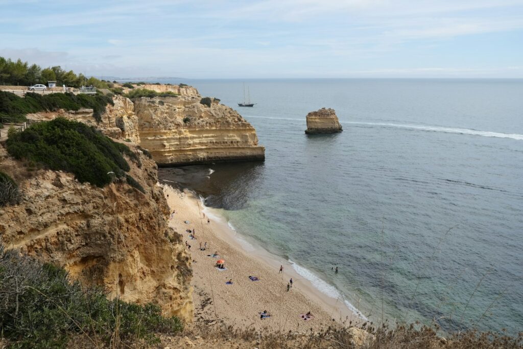
The clifftop walk between Praia da Marinha and Praia de Vale Centeanes: length, which way to walk, heat and cliff safety, and the Benagil rules.
The Seven Hanging Valleys trail is 5.7 km along the clifftops between Praia da Marinha and Praia de Vale Centeanes: do it in spring or autumn, start early, and plan how you get back.
The Seven Hanging Valleys trail (Percurso dos Sete Vales Suspensos) is a linear coastal walk in the municipality of Lagoa. The Lagoa council gives its length as 5.7 km between Praia de Vale Centeanes and Praia da Marinha, following an almost continuous line of cliffs. The tourism fact sheet rates it medium difficulty and gives spring and autumn as the best seasons.
The valleys are called hanging because the watercourses mostly end in the cliff above the sea rather than at beach level. Walking it is straightforward on a cool day and tough in midsummer heat, because the clifftop has almost no shade. The real planning question is not the route but the logistics: where you park and how you get back.
Route facts
| Fact | Detail | Source |
|---|---|---|
| Length | 5.7 km linking Praia de Vale Centeanes and Praia da Marinha | Lagoa council |
| Round trip | Listed as 11.20 km out and back | Welcome to Lagoa |
| Difficulty | Medium; linear route | Welcome to Lagoa |
| Altitude | Highest 45.5 m at Vale Centeanes; lowest 7.5 m at Benagil beach | Welcome to Lagoa |
| Marinha access | From the EN125, turn south beside the Escola Internacional do Algarve and follow the signs | Welcome to Lagoa |
| Vale Centeanes access | About 2 km east of the centre of Carvoeiro | Welcome to Lagoa |
| Duration and parking | No official figure is published | — |
The round-trip figure of 11.20 km is not exactly twice 5.7 km (which would be 11.4), so treat both as approximate. No official walking time is published: plan on a relaxed outing with stops, and more if you add swims at Benagil.
Cliffs
An almost continuous line of cliffs, broken only by the watercourses that cut the valleys.
Juniper scrub
The council describes the juniper thickets on the cliff tops as a relic plant community.
Seabirds and bats
Seabirds nest in the rock walls and bats use the sea caves; binoculars are worth the weight.
Benagil
The route drops to Benagil beach, its lowest point at 7.5 m.
Which way to walk, and how to get back
Marinha is the eastern end of the route and Vale Centeanes the western end. Both can be a start or an end, and the trail is linear, so you need a plan for the return. These are the realistic choices.
On parking: Marinha has a clifftop car park, which our beach data scores 3 out of 5 for availability (arrive early in July and August); check the signs on arrival for any charge this season. See our Praia da Marinha guide for the details. There is no confirmed bus stop at Marinha, so don’t plan a public-transport return.
Heat & cliff safety
Heads up: heat, wind and cliff edges
The clifftop has little shade. The tourism fact sheet advises avoiding very hot, stormy or windy days, and recommends comfortable clothing, sturdy footwear, and water. Stay on the existing paths and don’t take shortcuts, and keep away from the cliff edge, which erodes. At Marinha, Visit Algarve classes the beach as restricted-use because much of the sand is in a landslide-risk zone, so don’t sit under the cliff base.
Faro’s average July daytime high is 29.4°C and August 29.2°C, and the cliff tops can feel hotter in still air. Don’t pick plants, take your litter with you, and bring more water than you think you need. A hat and sun cream matter as much as the sturdy shoes the fact sheet asks for.
The Benagil section
The fact sheet gives Benagil beach as the lowest point on the route, so you will pass it on the way. If you stop there, know the rules for the cave, which are set by the Capitania do Porto de Portimão (Edital 019/2024, amended by Edital 009/2025):
- Not allowed: swimming into the Algar de Benagil, or landing on or using the sand inside it.
- Not allowed: unguided kayak and SUP rental or tours (banned since July 2025).
- Allowed within limits: boat trips and guided kayak groups, with the number of craft and the time inside limited.
No newer edital is published for 2026, but rules change, so check with the Capitania before you go. To see the caves from the water, compare trips in our Benagil boat tour guide or read boat vs kayak vs SUP, and see Praia de Benagil for the beach.
When to go
The fact sheet names spring and autumn as the best seasons, and the cooler months are the sensible ones for a shadeless cliff path. Check our April and October pages for the weather. In July and August, walk at dawn or skip it. In winter the trail can be a fine walk on a dry day, but cliff paths are slippery after rain, so be more careful.
Guided options & where to base yourself
If you would prefer a guide, or want the logistics handled, compare guided walks below. A guide solves the return problem, which is the main hassle on this route.
With your own car, the start points are within a short drive of Carvoeiro, which is the natural base, with restaurants and more coves. Our driving guide covers the roads, and our hiking guide puts this walk next to the other Algarve trails.
If you are driving, compare rental options before you arrive.
And for a base near both trailheads:
FAQ
How long is the Seven Hanging Valleys trail?
Is the Seven Hanging Valleys trail difficult?
Which end should I start from?
Can I swim into the Benagil cave on the walk?
When is the best time to walk it?
Is there parking at the start of the trail?

